Geographic Information Systems Graduate Certificate
Geographic Information Systems Graduate Certificate
UCF’s Geographic Information Systems Graduate Certificate
The Geographic Information Systems (GIS) Graduate Certificate offers students an interdisciplinary background in geography and technical skills in the application of GIS. This program will enhance the student’s ability to understand, visualize, and analyze geospatial data while addressing questions related to place and spatial interactions. Courses span several colleges and multiple programs.
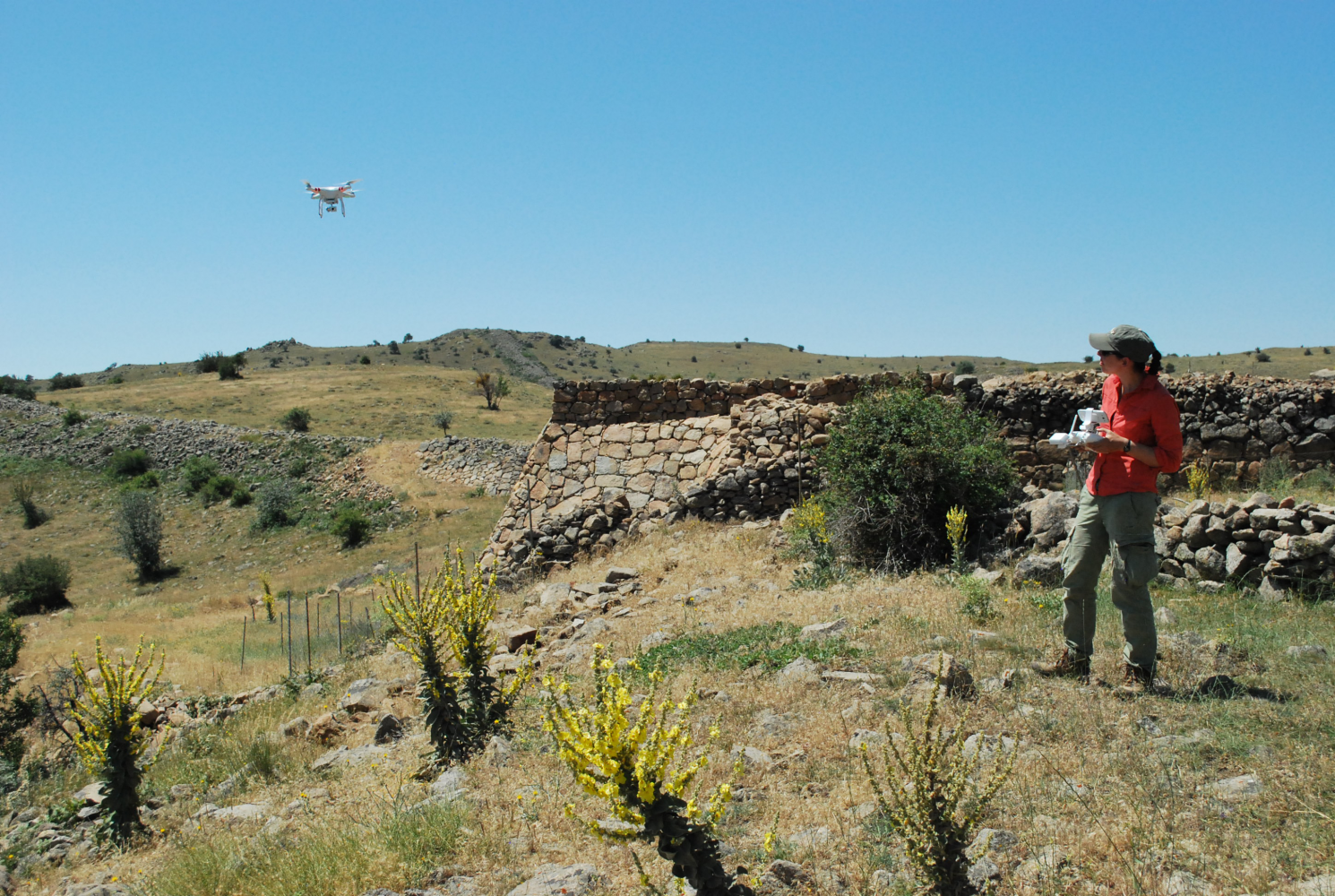
GIS and geospatial analyses allow students and researchers to see old problems in new ways, making connections by overlaying digital maps and examining spatial networks and processes. Spatial analysis is fundamental in some disciplines but is not evenly applied across the sciences (both natural and social) or the humanities. Defining a variable or question in a spatial format, or mapping something that has never been mapped, is transformative.
For example, breaking down data on urban populations by neighborhood, census tract, or address, allows sociologists, demographers, criminologists, public health workers, administrators, community leaders, and local and state politicians to incorporate spatial data into the decision-making process. A variety of private and public sources of information on workplace trends highlight GIS, spatial analysis, and geography as fast-growing fields. Across the country, universities and colleges with long traditions in geography, landscape architecture, and other spatially centered disciplines have pioneered GIS education, and other institutions have recognized that spatial literacy is vital across curricula. UCF faculty, staff, and students are currently developing a wide range of competencies in geospatial studies. A self-organizing community across the university is at work developing projects that incorporate expertise to generate new resources for students and research. The effectiveness of these efforts is multiplied by building collaborations across disciplinary and institutional lines.
Benefits
- The Bureau of Labor Statistics lists Geographic Information Systems training as a requirement for positions in geography and geospatial technologies, which are projected to grow by 29 percent between 2012-2022.
- A median salary is listed as $76k per year.
Curriculum
The certificate requires 12 credit hours of courses in competency areas of design, modeling, analysis, and visualization. To a certain extent, students may tailor their courses to focus on their broad disciplinary area of study.
Students will gain an understanding of a spectrum of concepts and corresponding skills. Through the core and elective courses, students will study all of the following:
- Data Modeling—beginning with basic data structures, including vector and raster data models, students will learn about how data is brought into GIS formats, and how information in their own disciplines can be thought of as part of a GIS database.
- Analytical Methods—includes basic methods such as querying, buffering, overlays and map algebra, as well as advanced topics such as the analysis of surfaces, spatial statistics, data mining, and network analysis.
- Design Aspects—the design of broader GIS systems, including databases, but also defining projects, working through the geographic problem-solving process, managing resources within GIS-based projects, and implementing planning and workflows.
- Cartography and Visualization—considerations from GIS data for print and online mapmaking, as well as principles of map design, and techniques for graphic representation, as well as a survey of history and trends, and the production, use, and evaluation of maps.
- Conceptual Foundations—includes philosophical, cognitive, and social foundations of GIS concepts, data, and analysis, as well as the study of error and imperfections in GIS data.
Application Requirements
- Official transcripts showing completed bachelor’s degree from a regionally accredited institution.
- Essay describing background and interests in relation to obtaining the certificate.
- Applicants must apply online at applynow.graduate.ucf.edu/apply
- Application deadline is July 15 for fall admission and December 1 for Spring admission
Faculty Profiles
|
|
 |
| Scott Branting, PhD Scott is an archaeologist and a specialist in Geographic Information Science. He holds advanced degrees in anthropology, geography, and Near Eastern languages and civilizations. He directs a major archaeological excavation in central Turkey, Kerkenes Dag, that makes extensive use of geophysical and remote sensing technologies to guide the excavations and to reconstruct and simulate the ancient city. As part of this effort, he led the development of agent-based pedestrian transportation models to explore the negotiation and use of space within the city by its inhabitants and their households. He is also actively involved in projects using satellite imagery to monitor cultural heritage at risk in the Middle East. | Yingru Li, PhD Yingru’s primary research areas include GIS and spatial statistics, environmental health, and economic/urban geography. Her research involves topics on socioeconomic inequalities, health and health care disparities, childhood obesity, retail location analysis and planning, water quality, and environmental pollution, as well as geospatial modeling. Her current research focuses on:
|
 |
|
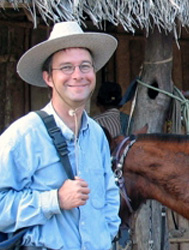
| John Walker, PhD John Walker PhD is an archaeologist working in the Bolivian Amazon, studying the link between social organization and spatial patterns by integrating survey and excavation into GIS using GPS and other technologies. He has worked in eastern Bolivia since 1992 and directs the Archaeological GIS Project of the Beni, a long-term project to systematize survey and excavation across the Beni and integrate it into a database accessible to Bolivian and international scholars. |
Contact:
John Walker, PhD
Program Director
john.walker@ucf.edu
407-823-3798
For more information:
Collaborating colleges and departments: College of Sciences (Anthropology, Biology, Political Science, Sociology, Statistics), College of Health and Public Affairs (Criminal Justice, Public Administration), College of Arts and Humanities (English, History, Philosophy), Office of Undergraduate Studies (Interdisciplinary Studies), College of Engineering and Computer Science (Civil, Environmental, and Construction, Computer Science), John C. Hitt Library, and College of Graduate Studies.